SKEALS
Spurn Kilnsea and Easington Area Local Studies
The Changing Face of Easington
There follows a series of articles on the changing face of the village of Easington.Showing some of the visual changes in buildings identified with maps, with some historical notes and a few local tales thrown in for interest.
Over the years there have been a number of archaeological digs, and these have revealed a rich history, with evidence of occupations from the Neolithic Age, Bronze Age and Iron Age, then Romano-British and Roman period.

Inclosure map of 1771
The old Inclosure coloured green

The village around 1771

The village around 2001
The church of All Saint’s was built and consecrated in 1190, built on an earlier building that existed there and is thought to have been of Saxon origin.
The area has mostly predominantly been agricultural and fishing back ground with arable farming being most prevalent. As with nearly all villages there were also many trades that kept a village alive and thriving, records show the list of trades including brick layers, carpenters, blacksmiths, wheelwrights, cobblers, milliners, tailors, millers,(There is mention of a windmill in 1260) butchers, shop keepers, inn-keepers and at one time a taxidermist!
Moving through time to the present day, there have been many modern developments in and around the village, with the discovery of North Sea gas in 1966, first natural gas in the country coming ashore in 1967. There are now three main gas terminals here, with the original BP terminal now almost totally dismantled. Seven wind powered turbines based on shore and two large off shore wind farms, now starting a new development of carbon capture, Easington is an integral part of the energy coast and a major contributor of the nation’s energy.
In addition the local caravan sites of Long Beach and Sandy Beaches at Kilnsea, they have played an important part in the growing development of the area with tourism and ornithology.
Compiled by
Mike Welton.
2023 The Changing Face of Easington - Baulk End
When approaching the village of Easington, on what is now referred to as Hull Road, it was in the past called Skeffling Road, as this was the next village along from Easington, but with the advent of many more people travelling for both jobs and leisure, it shows how the boundaries of people’s worlds have expanded over the years.
On the original Enclosure map of Easington 1771, this only shows landowners, and no buildings or dwellings are visible. Only four buildings are shown at Baulk End.

Enclosure map 1771

Enclosure map 1888
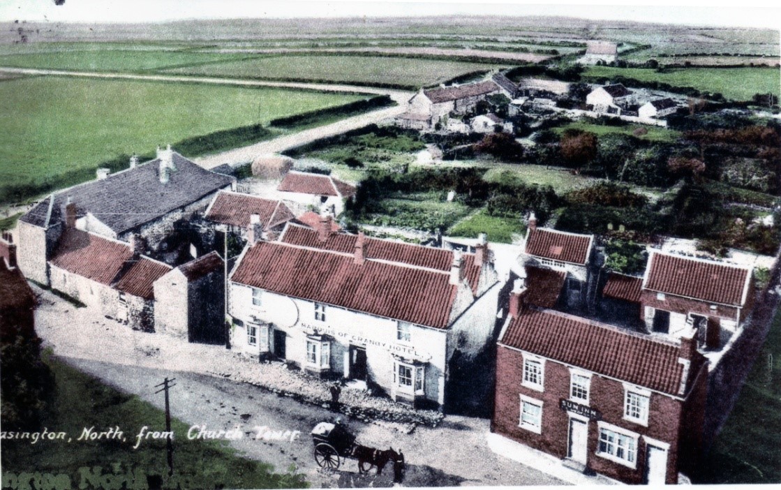
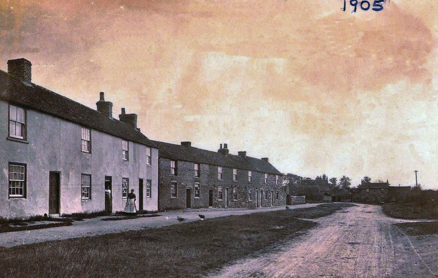
A post card from 1905 clearly shows the open road out of the village
with no other buildings in sight, and the farm house on the corner.

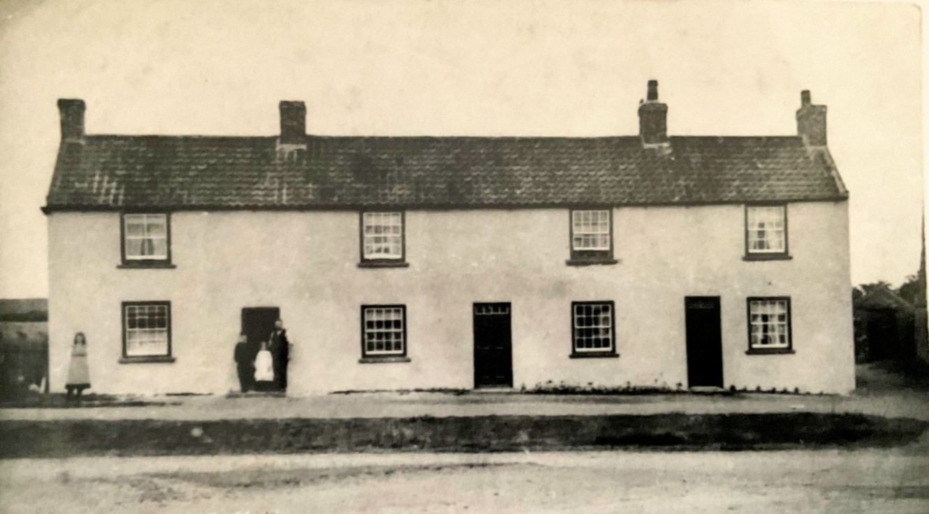
A further view of the farm house on the corner
after a barn had been turned in to a dwelling.

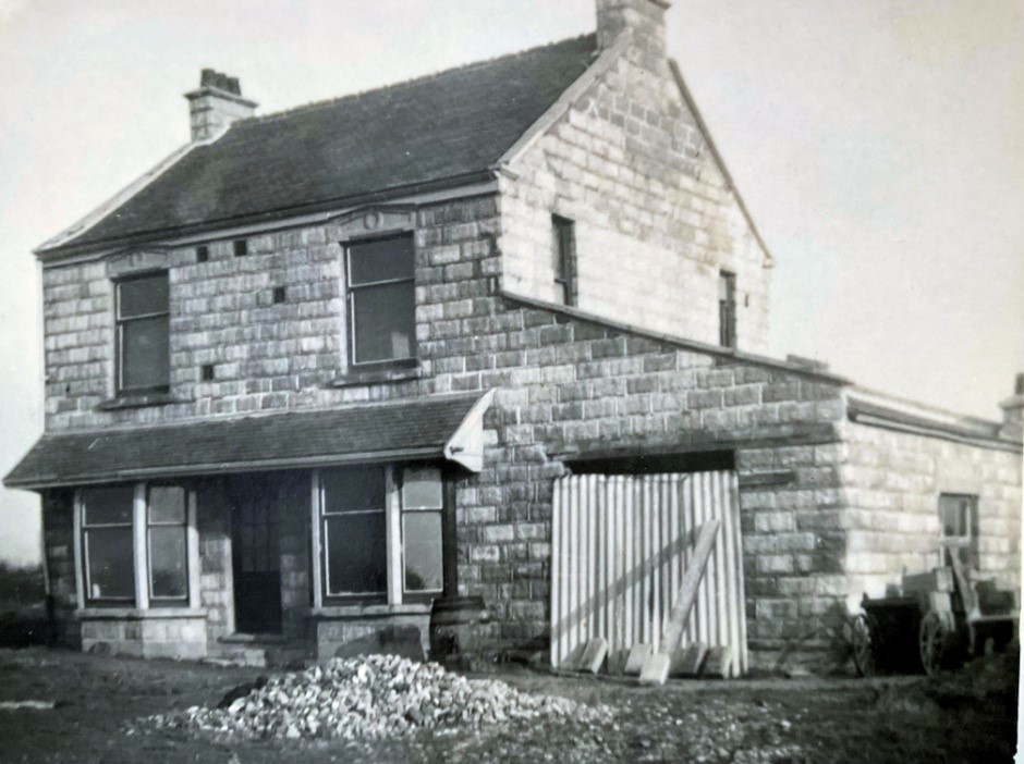
First recorded dwelling - High House.
The White House.
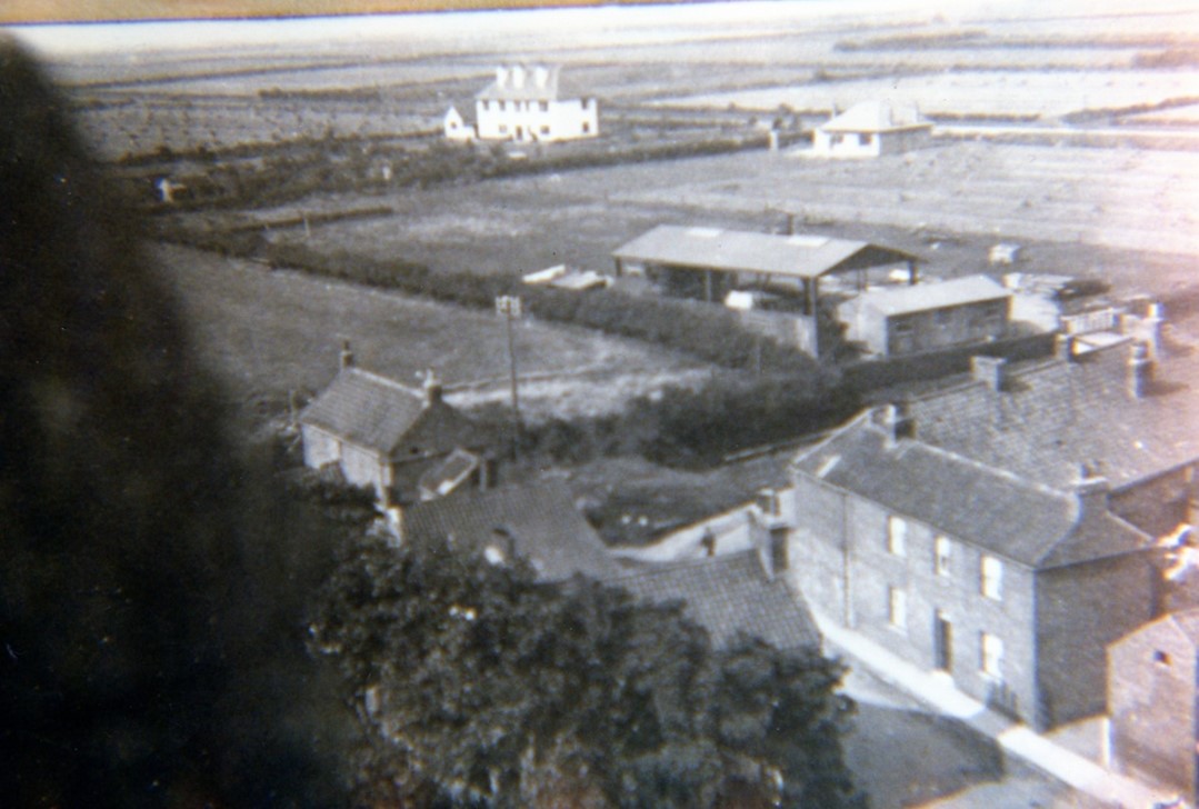
The Vicarage 1922.
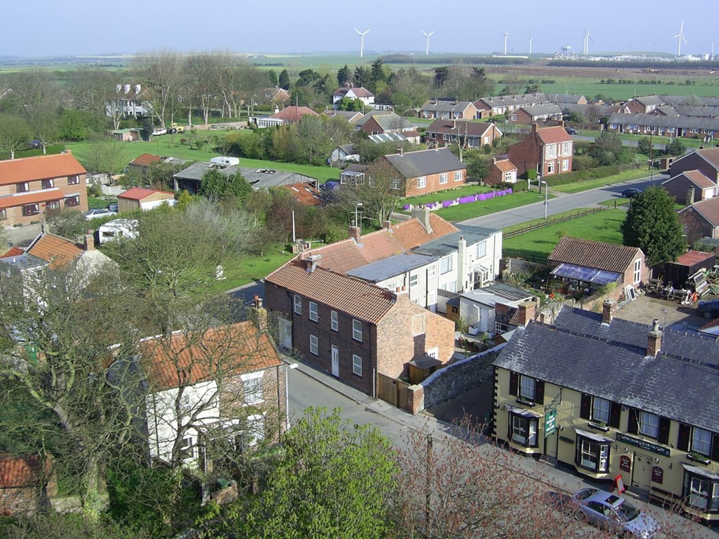
Hull Road - present day.
There were two blocks of cottages; on the left was a block of three that were always painted white, alongside another block of six, these were of cobble stone construction. A resident of Easington an old gentleman called Mr George Failey who was in his nineties, lived in the first cottage on the left, he struck quite a sight sat in his chair outside his house, with a long flowing white beard, usually reading a news paper. The house did not have electricity and sole means of lighting were oil lamps, he usually retired to bed as soon as darkness set in and arose with the morning sunrise.
Also approaching Baulk End, there was at one time a St. John Ambulance hut on the right hand side of the road.(You can just see the window of one of the cottages in the background).
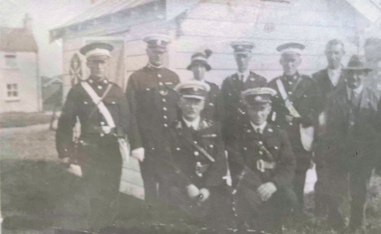
St. John Ambulance volunteers.
Baulk End cottages.
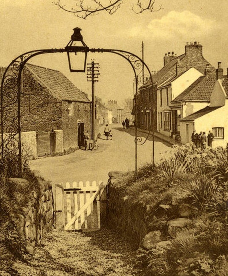
A view of Baulk End looking towards Blacksmith’s Corner.
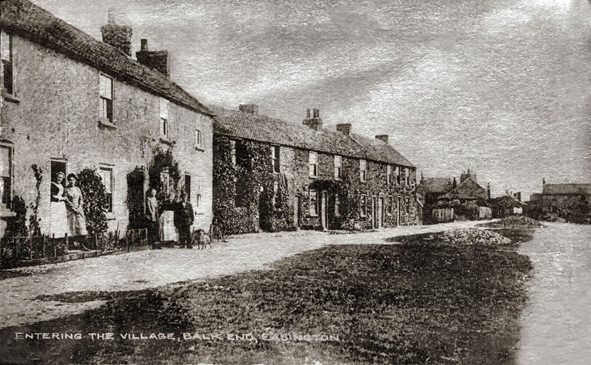
Another view of Baulk End looking towards Blacksmith’s Corner.

A later view of Baulk End looking towards Blacksmiths Corner.
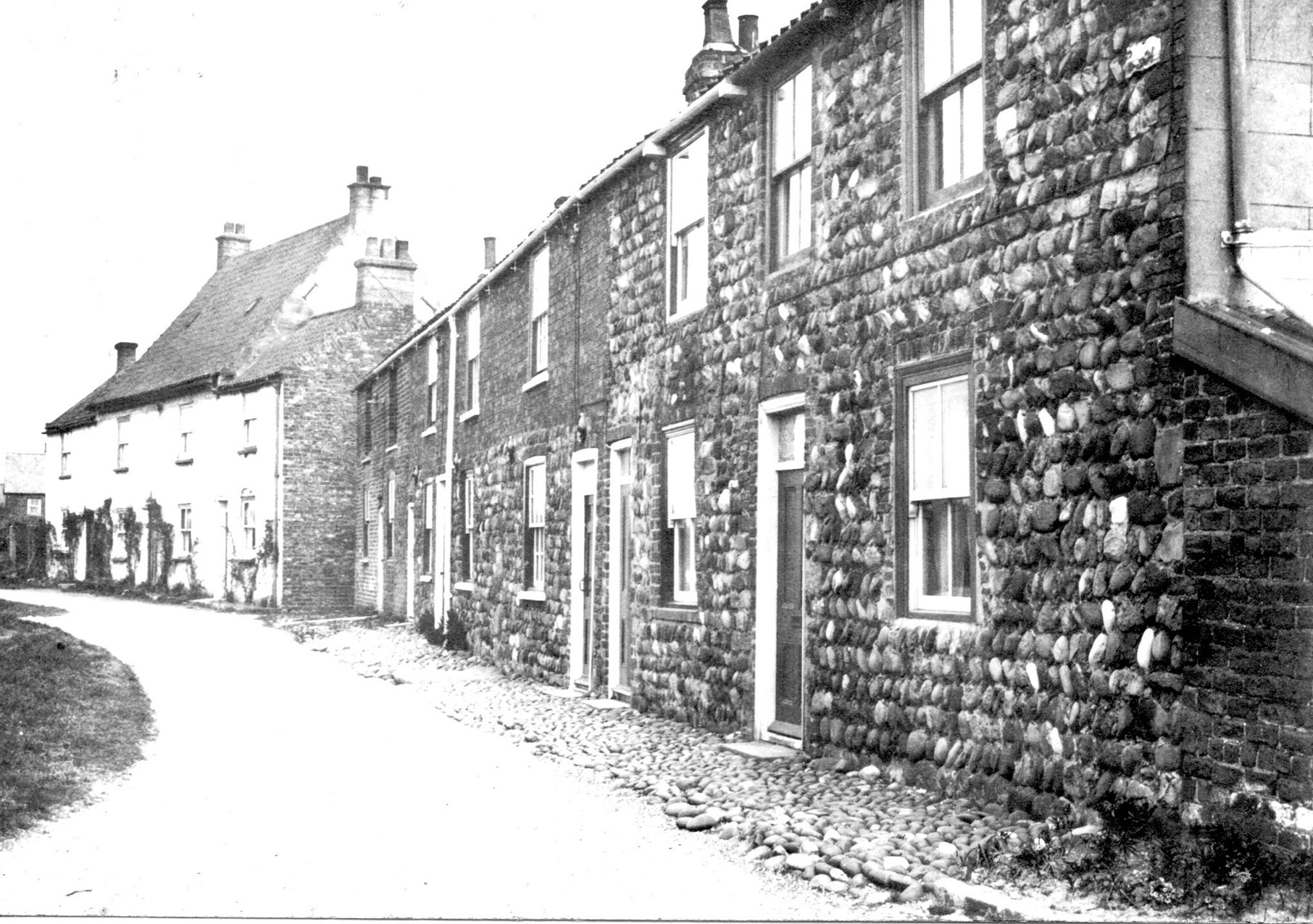
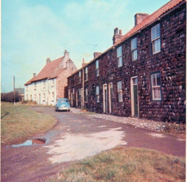
2 views of Baulk End Cottages one taken in 1955 and one in 1965.
There is very little change.

Photo showing halfway through the demolition of the cottages, around 1970s.
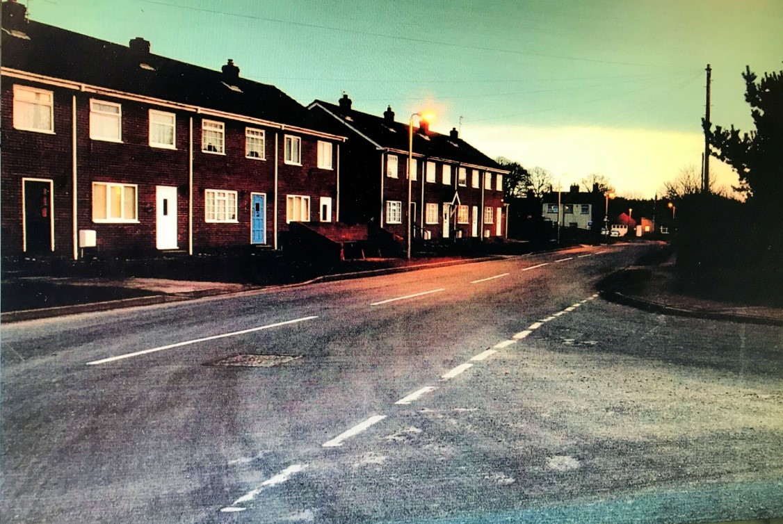
Briary Cottages built on the site of the old Baulk End cottages.
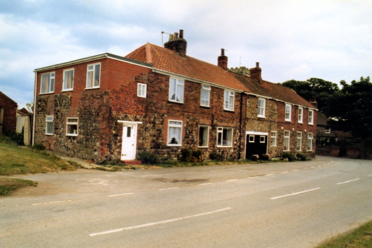
A later picture of Baulk End Cottages with the workshop now used as a garage.

An even later photo of Baulk End, with the end building having been rendered.
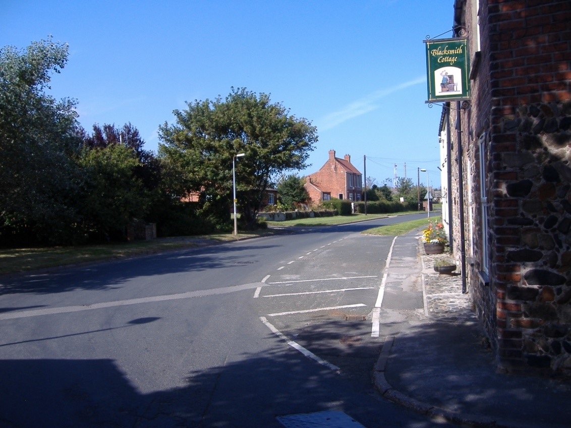
Cottage on the corner named as Blacksmiths Cottage when a guest house.
In times past, virtually every village had a Blacksmith; he was an essential part of the village community, particularly in farming areas, when equipment and horses were a part of everyday life. Easington was no exception; there have been a number of Blacksmiths who have lived in the village over the years, recorded in the Parish records, here are some of them.
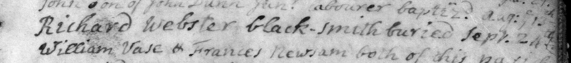
Burial of Richard Webster, Blacksmith buried Sept 24th 1732
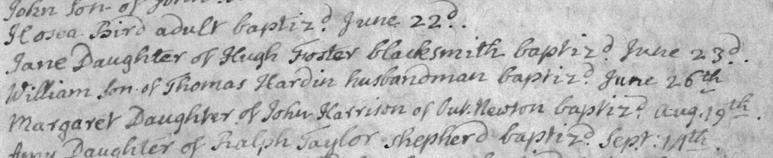
Baptism of Jane, daug. of Hugh Foster, Blacksmith June 23rd 1735
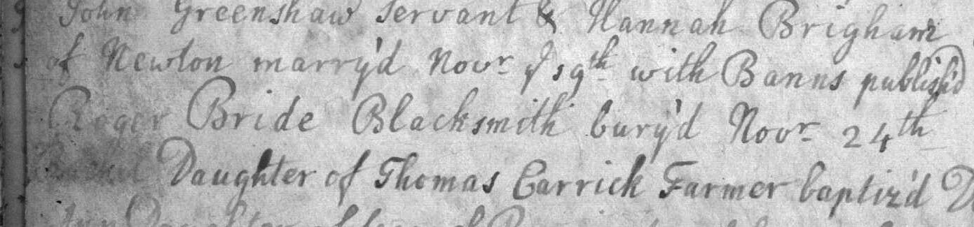
Burial of Roger Bride, Blacksmith Nov 24th 1739

Burial of Robert Wright, Blacksmith April 19th 1813

|
|

|

|

The Blacksmith's shop and an adjoining barn at Blacksmiths Corner Easington

A view inside the blacksmiths shop, with L - R,
Reg Clubley, Len Clubley, George Brown (Blacksmith) John Drewery (Apprentice)
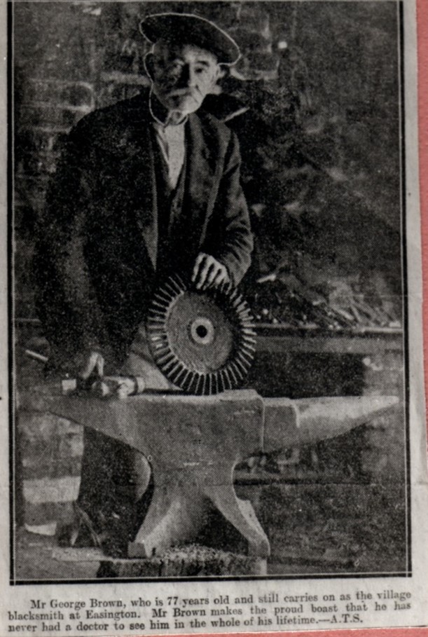
George Brown pictured here aged 77 years old,
he claimed he had never been to a see a doctor his whole life.

The blacksmiths shop, with the pond on the right
The open doors on the left of the picture below, mid-way along the block, belonged to a joiners shop. So the story goes, the owner, whose father had been buried in the old Kilnsea churchyard, when the church and churchyard fell into the sea in 1831, he retrieved his father’s remains from the crumbling cliff, the bones were kept for many years in a box in the workshop, when the local vicar eventually heard of this story he tried to persuade the man to re-inter his remains in the churchyard, but the man refused, saying that ‘He was not paying twice to have the same man buried!’

George Brown pictured with his dog (1931),
in the background the joiners shop doors are visible
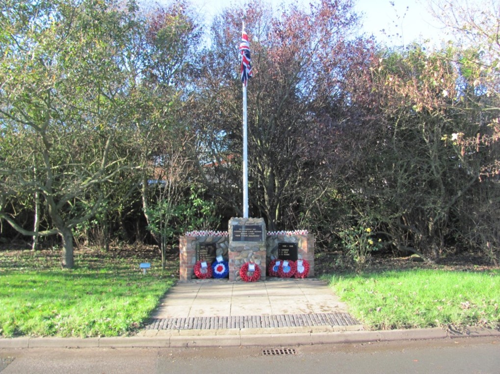
The pond was filled in during the 1970s and is now the site of the Easington War Memorial,
and the mill stone from the Dimlington windmill (below)


The farm house on the corner

The main house became a holiday home, later it became the Corner Cottage Guest house, then changed its name to Blacksmith’s Cottage.
then changed its name to Blacksmith’s Cottage

Baulk End approaching Blacksmith’s corner

A later view with the cottage rendered